How are overflights affecting you?
The number, type, and sometimes altitudes of flights over your location can vary by the day, or even by the hour! From the frequency of overflights to the average overflight altitude, we aim to give you a clear picture of how overflights commonly affect your area.
How are areas affected differently?
There are a number of factors that influence the frequency and position of overflights:
- The number and frequency of flights will vary on a daily, weekly, and yearly basis due to differences in airline schedules. The airlines schedule flights in response to consumer demand. This is particularly the case around holiday periods.
- The runway in use at any given time will also vary, largely due to the wind conditions. Each runway has its own set of flight paths, and each flight path will affect different areas. As the runway in use changes, the flight paths change, and so too do the areas affected.
- The altitude of aircraft can vary due to a number of factors. It could depend on which airport the flight is going to, or from and whether it is an arrival or departure. Arrivals are typically following a steady descent to the runway whilst departures are typically following a steeper path as they climb away from the runway.

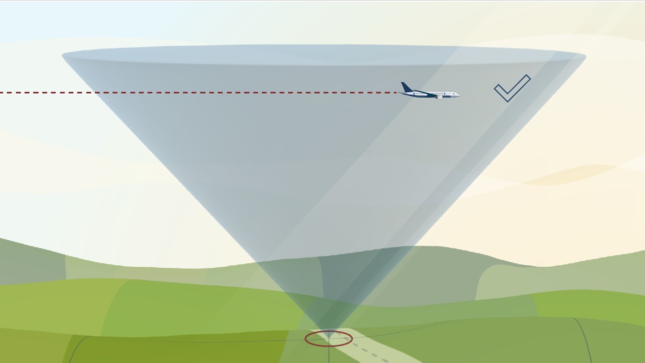
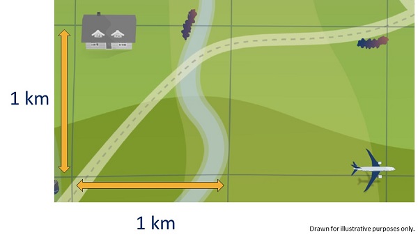
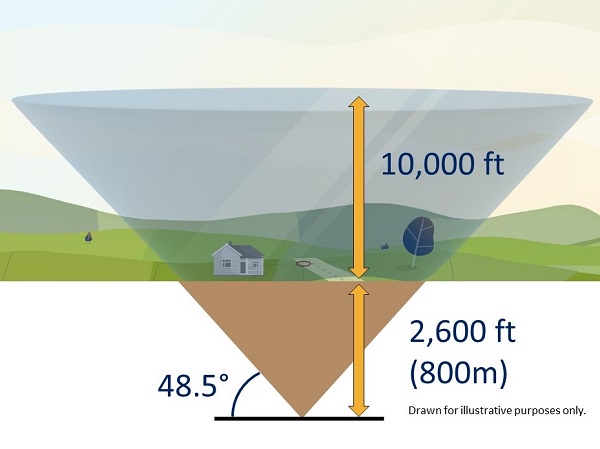
Interested to know how we calculate overflights?